Leave Your Message

What Is a 3D Drone Light Show and How Does It Work?

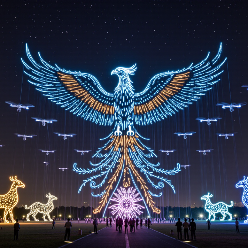
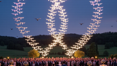
A 3d Drone Light Show transforms the night sky into a moving canvas of light. Instead of using fireworks, it uses many small drones equipped with bright LED systems. Each aircraft follows a carefully designed route through three-dimensional space. Together, the drones form animals, logos, words, and shifting geometric patterns. It looks like magic.

How does this coordinated display work? Specialized software converts visual designs into thousands of flight instructions. These instructions control each drone’s position, speed, brightness, and timing. Before launch, technicians test the formation in simulation and inspect batteries, communication systems, and navigation equipment. During the performance, a ground control team monitors the fleet and responds to unexpected changes. Weather matters. Wind, rain, temperature, and visibility can affect the result. Professional operators also maintain safe distances from audiences, buildings, and restricted areas.

Yet the spectacle is not completely flawless. A 3d Drone Light Show may contain small gaps, delayed movements, or imperfect shapes. These details often reveal the limits of battery life, signal reliability, and real-world weather. Unlike a digital animation, a live drone display must obey physics. The technology is impressive, but it still requires judgment.

Understanding this process helps audiences appreciate both the creativity and the engineering behind each performance. Reliable providers combine experienced pilots, tested equipment, qualified technicians, and responsible planning. When evaluating a show, readers should look beyond bright images. Safety procedures, operating permissions, technical rehearsals, and transparent event planning matter just as much as visual impact.

What Is a 3D Drone Light Show and How Does It Work?

What Defines a 3D Drone Light Show?

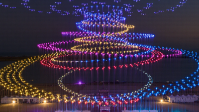
A 3D drone light show is defined by depth, not by colorful animation alone. Each drone acts as a moving pixel in three-dimensional space. Its programmed position includes horizontal, vertical, and forward-backward coordinates. Together, these points create spheres, rotating rings, animals, or architectural forms that change with perspective. A flat screen can imitate depth, but it cannot physically occupy the sky.

In practice, the effect depends on accurate timing, positioning, and controlled movement. Drones must maintain safe separation while following synchronized flight paths. Their lights change brightness and color at precise moments. Viewers may notice depth when the formation moves, expands, or passes behind another shape. The illusion weakens from a poor viewing angle. That limitation matters.

The term is not perfectly standardized.

The U.S. Federal Aviation Administration’s Aerospace Forecast 2024–2044 projects nearly one million commercial small drones operating in the United States by 2029. This growth supports larger, more technically demanding aerial displays, but fleet size alone does not create 3D imagery. Research from MarketsandMarkets estimates the drone services market could grow from about 17 billion dollars in 2023 to nearly 58 billion dollars by 2030. These figures show rising capability, not guaranteed artistic quality. A convincing 3D show still requires spatial design, flight validation, weather monitoring, and careful audience positioning. Even then, wind, haze, and human perception can produce imperfect results. That imperfection is part of the technology’s reality.

What Is a 3D Drone Light Show and How Does It Work?

A 3D drone light show creates images and animations by coordinating each drone’s position across three spatial axes: horizontal position, depth, and altitude. The chart shows an illustrative flight volume measured in metres.

What defines the 3D effect? Unlike a flat formation, drones can move forward and backward as well as side to side and up and down. A flight-control system assigns each drone time-based coordinates on the X, Y, and Z axes, while onboard LEDs create the visible points of light.

Which Technologies Power a 3D Drone Light Show?

What Is a 3D Drone Light Show and How Does It Work?

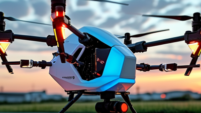
A 3D drone light show creates depth through coordinated movement, not solid objects in the sky. Hundreds of drones follow timed flight paths, forming rotating animals, buildings, or floating symbols. Each unit carries programmable RGB LEDs, a flight controller, a battery, and positioning sensors. According to a 2024 Grand View Research report, the global commercial drone market reached tens of billions of dollars, reflecting rapid investment in autonomous flight systems. The figure is useful, but it does not measure entertainment quality.

Accurate positioning powers the visual effect. GNSS provides global location, while RTK corrections can improve horizontal accuracy to centimeter-level conditions. An inertial measurement unit tracks motion, and a barometer helps control altitude. The system combines these inputs before sending each drone a separate waypoint sequence. A central platform monitors telemetry, battery levels, spacing, and communication links. Short-range positioning can strengthen performance near buildings or during signal interference. Small errors still matter.

LED brightness, refresh rates, and color calibration shape the audience’s experience. High-intensity lights remain visible against dark skies, while carefully limited brightness reduces visual fatigue. A 2024 report from the International Data Corporation places continued growth in autonomous systems alongside stronger demand for edge computing, which supports local flight decisions. Yet reports often simplify real conditions. Wind, battery temperature, and imperfect positioning can disrupt a perfect rehearsal. Reliable shows need repeated testing, conservative spacing, and trained operators who can pause the performance.

How Drones Are Programmed to Form Three-Dimensional Images

What Is a 3D Drone Light Show and How Does It Work?

How Drones Are Programmed to Form Three-Dimensional Images

A 3D drone light show uses many small aircraft as moving pixels in the night sky. Each drone carries a bright light and follows a carefully calculated flight path. Together, these points create animals, symbols, letters, or rotating geometric shapes. The image is not projected onto a screen. It is built from hundreds of changing positions.

Programmers begin with a three-dimensional model, often made from connected points and surfaces. Special software converts that model into individual coordinates for each drone. Every aircraft receives a timeline containing its position, speed, light color, and brightness. Timing matters. If one drone arrives late, a smooth curve may look broken. Small errors grow.

Before a public performance, engineers simulate the formation digitally and check spacing between aircraft. They also define safe altitude limits, emergency landing areas, communication checks, and weather restrictions. Positioning systems help drones maintain their assigned coordinates, while onboard controls adjust movement during flight. The light sequence must match the motion, or the shape can appear flat instead of three-dimensional.

A practical test often reveals unexpected problems. Wind can stretch a formation, while battery limits may shorten the planned sequence. Engineers may simplify a detailed model to improve stability and visibility. It looks effortless. In reality, each glowing point depends on navigation data, tested software, trained operators, and repeated safety reviews. A perfect animation on a monitor still needs careful judgment in the real sky.

How Flight Coordination Creates the 3D Visual Effect

A 3D drone light show uses hundreds of illuminated drones as moving pixels in the night sky. Each aircraft follows a carefully calculated position, height, speed, and timing command. Together, these movements create shapes that appear to float, rotate, expand, or move toward the audience.

Flight coordination creates the three-dimensional effect. Software divides the animation into precise coordinates across three axes: length, width, and altitude. Drones at different heights form depth, while controlled spacing creates perspective. The viewing angle matters greatly. A design may look like a sphere from the audience area but appear flat from the side. Color changes, brightness, and gradual movement strengthen the illusion.

Timing must be extremely accurate. Drones use satellite positioning, onboard sensors, and communication systems to maintain their assigned paths. Operators also check wind, battery levels, launch spacing, and emergency procedures before the performance. A rehearsal helps identify overlapping routes or weak visual transitions. Still, the effect is not truly solid. It is a visual interpretation built from light, distance, and motion. Small timing errors may remain, especially in changing weather. That imperfection deserves attention, because reliable shows depend on continuous monitoring rather than automation alone.

Where 3D Drone Light Shows Are Used and What Safety Requires

A 3D drone light show uses hundreds of synchronized aircraft to create floating images, shapes, and moving scenes. Software assigns each drone a precise position, color, speed, and timing. Viewers see a three-dimensional illusion above a stadium, waterfront, or historic square. In the 2024 Drone Industry Insights Drone Market Report, the global drone market is forecast to reach about 54.6 billion dollars by 2030. That growth may support more public performances, but scale also increases operational pressure.

Drone shows are used at festivals, tourism events, sports ceremonies, cultural celebrations, and outdoor storytelling projects. Cities can replace some fireworks with quieter aerial displays. Not always, though. Drones still produce noise, light, and temporary airspace restrictions. Event planners should consider nearby homes, wildlife, hospitals, airports, and people with sensory sensitivities. A smaller formation may serve the audience better.

Safety begins before launch. Operators need airspace approval, pilot qualifications, aircraft registration, geofencing, and a documented risk assessment. Requirements vary by country. In the United States, the Federal Aviation Administration reported more than 800,000 registered drones in its 2024 UAS safety materials, showing why controlled operations matter. European guidance also emphasizes ground-risk assessment, separation distances, remote identification, and emergency procedures. Teams should use weather monitoring, battery checks, redundant communication, exclusion zones, trained observers, and a clear abort plan. A perfect formation is not the whole story. One weak link can disrupt the performance.

What Is a 3D Drone Light Show and How Does It Work? - Where 3D Drone Light Shows Are Used and What Safety Requires

Dimension Key Information Typical Facts, Requirements, or Examples
Definition A drone light show is a coordinated aerial performance in which multiple small unmanned aircraft carry programmable lights and fly synchronized trajectories. The aircraft normally use high-intensity, full-color LED lighting to create moving patterns, words, logos, geometric forms, and three-dimensional visual effects in the night sky.
Meaning of “3D” “3D” refers to the use of three-dimensional space rather than a single flat plane. The formation can change its horizontal position, altitude, depth, orientation, and shape over time, allowing viewers to perceive volume and movement from a designated viewing area.
Main Components A complete system combines aircraft, LED payloads, batteries, positioning equipment, communication links, flight-control software, and an operator station. Shows commonly require a fleet of identical or compatible drones, spare aircraft, charging equipment, launch and recovery areas, monitoring tools, and an emergency control system.
How the Show Is Designed Designers first create visual sequences and convert them into three-dimensional waypoints, timing data, colors, and flight behaviors. The animation is then checked against aircraft limits, minimum spacing, battery capacity, geofencing rules, communication coverage, and the planned audience viewpoint.
Flight Coordination Each drone receives an individual flight path and a synchronized lighting timeline. Positioning systems and onboard flight controllers help maintain formation. The control system must manage timing, navigation, telemetry, and abnormal-flight responses without relying on the audience to control the aircraft.
Positioning and Navigation Accurate positioning is essential because many aircraft may operate close to one another. Satellite navigation may be supplemented by other positioning or correction technologies. Performance can be affected by signal obstruction, interference, weather, terrain, and nearby structures.
Lighting System LED modules produce the visible colors and brightness changes that form the animation. Color is generally created by combining red, green, and blue light sources. Light output must be balanced so that the display is visible without creating unnecessary glare or distracting nearby pilots, drivers, or residents.
Typical Show Duration The performance length depends on the story, music, battery capacity, operating conditions, and turnaround requirements. Many public demonstrations last approximately 8–15 minutes, although shorter or longer programs are possible. Battery planning must include takeoff, flight, return, landing, and a safety reserve.
Audience Viewing Three-dimensional formations are designed for a specific viewing direction and site layout. The organizer normally defines a spectator area, a display volume, launch and recovery zones, restricted areas, emergency access routes, and suitable viewing distances before the show is approved.
Common Uses Drone light shows are used where organizers want a programmable aerial display with reduced smoke, fire, or physical infrastructure compared with some traditional alternatives. Typical uses include civic celebrations, festivals, sporting events, cultural programs, tourism events, product or message presentations, holiday programs, and educational demonstrations.
Environmental Conditions Weather directly affects aircraft stability, visibility, battery performance, and operational safety. Strong wind, heavy rain, lightning, fog, icing, extreme temperatures, and poor visibility may require postponement or cancellation. The operator should establish measurable weather limits before launch.
Airspace Assessment The operating area must be evaluated for nearby airports, heliports, temporary flight restrictions, controlled airspace, buildings, power lines, roads, waterways, and other aircraft activity. Airspace requirements differ by country and location. A show may require advance authorization, coordination with aviation authorities, or restrictions on altitude, operating time, and location.
Spectator Protection Spectators should not be placed beneath or inside the planned flight paths unless specifically permitted by applicable rules and supported by a suitable risk assessment. Organizers should use clearly marked boundaries, barriers where appropriate, trained event staff, controlled access points, and emergency procedures for an aircraft deviation, hard landing, or loss of lighting.
Separation and Geofencing Software and operational procedures are used to keep drones within the approved display volume and separated from one another and from hazards. Virtual boundaries can prevent entry into defined exclusion zones, but geofencing is not a substitute for pilot supervision, visual monitoring, site control, or compliance with local aviation regulations.
Communication Reliability The control link and telemetry link must remain dependable throughout the performance. Operators should assess radio-frequency interference, maintain adequate coverage, monitor connection status, and define what each aircraft will do if communication is interrupted.
Emergency Procedures A written emergency plan is required to address predictable failures and external hazards. Procedures may include controlled landing or return behavior, show termination, audience notification, coordination with emergency services, handling of a lost aircraft, and reporting of incidents.
Battery and Fire Safety Rechargeable lithium-based batteries require careful inspection, charging, transport, storage, and disposal. Damaged, swollen, overheated, or unusually discharged batteries should be removed from service. Charging should be supervised in a suitable area with fire-control procedures and access restrictions.
Pre-Show Testing Testing confirms that the animation, aircraft, software, communications, and site plan work together as expected. Good practice includes equipment inspection, battery checks, compass and positioning checks where applicable, communication tests, limited rehearsal, weather review, and confirmation of the emergency stop process.
Regulatory Responsibility The operator and event organizer are responsible for complying with the rules that apply to unmanned aircraft, public events, privacy, noise, and emergency management. Requirements vary by jurisdiction and may include pilot qualifications, operational permissions, insurance, risk assessments, notices to aviation authorities, and coordination with local authorities.
Advantages Drone shows can create repeatable, software-controlled aerial graphics without launching burning projectiles. Potential benefits include reusability, programmable motion, adaptable storytelling, lower physical waste than some pyrotechnic displays, and the ability to combine light, music, and data-driven animation.
Limitations Drone shows depend on technology, weather, airspace availability, battery capacity, and suitable separation from people and hazards. They may be unsuitable near busy airports, in severe weather, in locations with poor positioning or communication conditions, or where local regulations do not permit the planned operation.
Core Safety Principle Safety takes priority over visual performance and schedule. A responsible operator should be prepared to delay, modify, or cancel the show when weather, equipment condition, airspace, communications, crowd control, or other risk factors fall outside approved limits.
Note: Exact operating limits, approvals, pilot qualifications, insurance requirements, and spectator-separation rules depend on the country, aviation authority, aircraft category, venue, and event conditions. The local regulations and the approved site-specific safety plan should always take precedence.